
How would you define a territory? This question appeared at the top of the exhibition space for “Memories of the land: Leónidas Gambartes”, as well as the project’s website during the first phase of the (un)realities project, establishing the premises of the exhibition from the outset:
1. This concept is central to Gambartes’ work
2. In this exhibition, we will talk about more than just the artworks themselves
3. Active participation is a key part of the experience
4. It is open to listening to and including the public’s voices
This pedagogical tool, part of the first phase of the (un)realities project, was named the Concept map. This initiative offered an interactive experience – available both in the gallery and digitally – that invited visitors to reflect on what we understand by “territory”. Far from representing a physical location, this map captures the perceptions, ideas and associations that were collectively constructed throughout the exhibition.
Over the course of the 15-month exhibition, the tool gathered public contributions through a system of voting and open participation. Starting with an initial selection of concepts proposed by the curatorial team, participants could choose those they considered most representative, as well as adding new terms. The result is a living concept map that is constantly evolving and visible in real time.
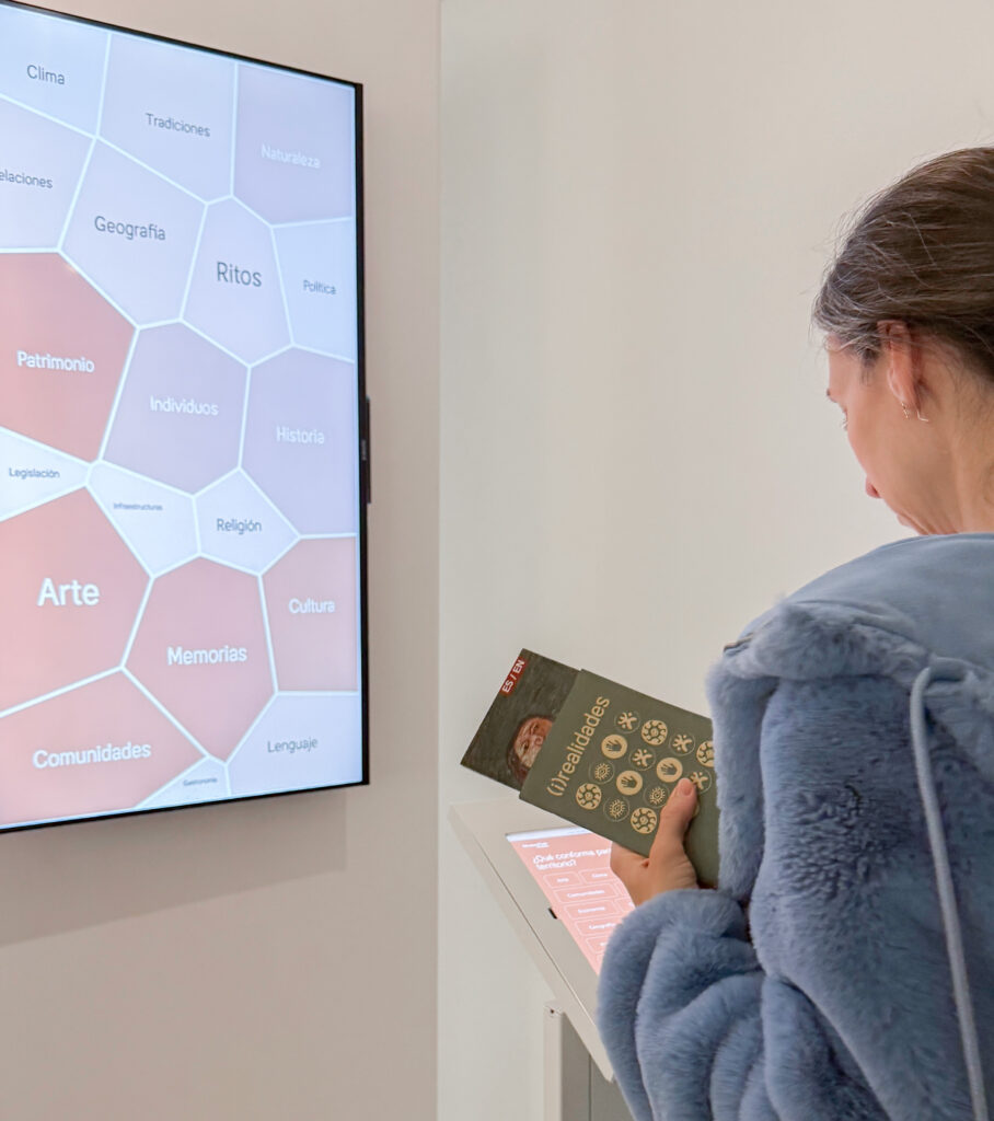
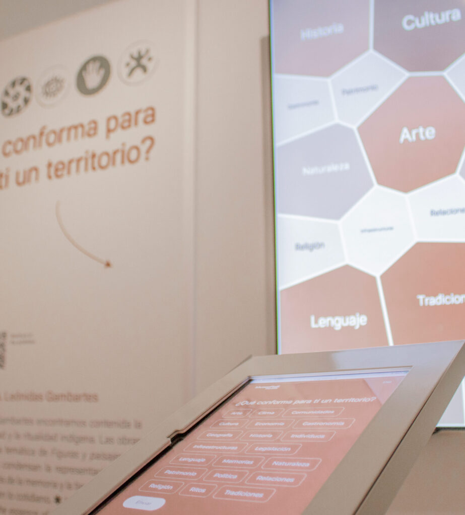
This collective exercise connects directly to one of the central themes in Leónidas Gambartes’ work: telluric aspects, understood as the profound relationship between land, culture and identity. The tool focuses the visitor’s attention on this quality of his work, broadening the exhibition experience and inviting people to consider territory as a complex reality that encompasses cultural, emotional and symbolic dimensions. In turn, it provided an opportunity to open up this reflection, allowing us to construct a collective definition and map how our audiences understand this term.
One of the most significant aspects of this tool is specifically its temporal dimension. Throughout the activation period, not only do the positions of the terms shift, but significant changes in voting trends also occur at certain moments. Concepts that initially did not hold prominent positions progressively gain greater relevance, thereby reorganising the map as a whole.
A clear example of this phenomenon is the term geography. Despite being typically associated with defining territory, it was not particularly prominent during the initial months when the tool started to be used. However, at a later stage – towards the summer of 2025 – it started to experience a marked increase in votes, rising to become one of the most frequently cited concepts and quickly overtaking the term art, which had been one of the most voted from the start. This shift introduces a significant change in the overall reading of the map and reveals that the public’s conceptual priorities are not static.
Such shifts do not occur in isolation. Other terms – such as religion, politics, language and community – have also seen increases at various points during the exhibition period, while concepts like culture, history and traditions maintain a constant presence over time. Alongside these, terms such as nature, memory, gastronomy, individuals and heritage appear repeatedly; while they may not be in the top position on the map, their presence remains consistent.
Conversely, concepts such as legislation, infrastructure, rituals and the economy rank among the least voted, offering a particularly interesting perspective from a sociological standpoint. Although these categories are essentially at the heart of the material organisation of contemporary territories, they appear less frequently in the symbolic definition constructed by the public within the context of the tool.
These variations allow us to view the map not as a snapshot of public opinion, but as an evolving narrative situated in time. This narrative is shaped by the profiles of visitors during each period, the ways in which the tool is used, and the social and political contexts that accompany the exhibition experience.
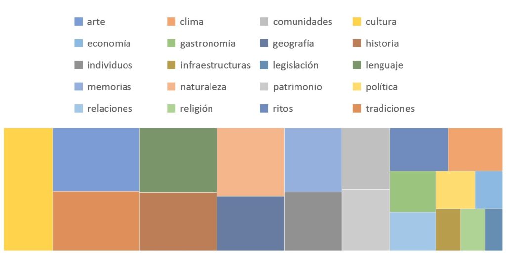
Overall, the final results place concepts such as culture, history, traditions, geography and language in prominent positions, followed by others like art, communities and memory. Together, these terms form a shared image that allows us to consider which elements are most immediately associated with the idea of territory within the exhibition’s framework. The terms contributed by the public to this concept map of the territory are: identity, community, music, architecture, customs, dance, footprint, textures, sphere and body.
Together, these elements make up a dynamic map that reveals how constructing the meaning of territory is a situated process. Although the aim of the tool was not to conduct a sociological analysis in the strictest sense, but rather to activate the experience of individual and collective reflection in dialogue with Leónidas Gambartes’ work, interpreting the data gives us a wider understanding of how ideas regarding territory are constructed today.
.
